Bac Giang Overview
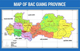
Locating in the Northeastern region of Vietnam, Bac Giang province is on the Lang Son - Hanoi - Ho Chi Minh City - Moc Bai economic corridor (in the Nanning - Singapore Corridor). The province borders Hanoi Capital, Bac Ninh, Hai Duong, Lang Son, Quang Ninh, Thai Nguyen and adjacent to Hanoi - Hai Phong - Quang Ninh economic triangle.
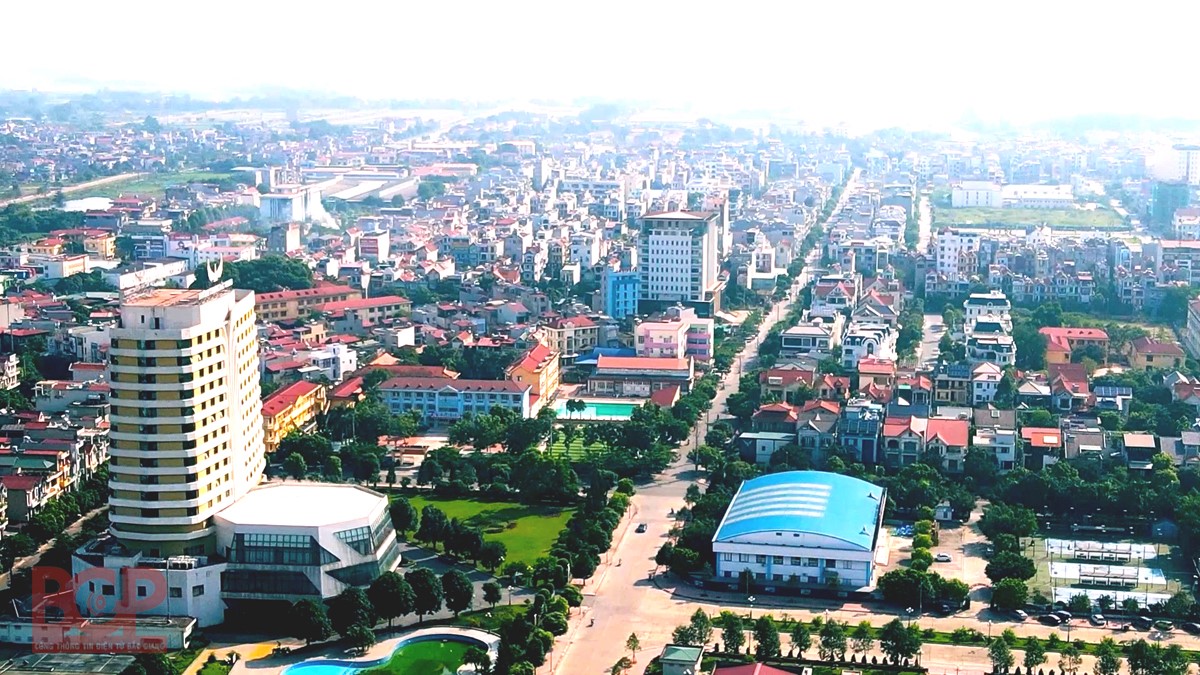
With a natural land of 3,895 square kilometers, and a population of over 1.8 million people, the province has 09 administrative units at district level and 01 city. Bac Giang city is the administrative center of the province. The city is 50 kilometers away from Hanoi capital, 110 kilometers away from Huu Nghi (Lang Son) border gate, 50 kilometers away from Noi Bai international airport, 130 kilometers away from Hai Phong seaport and Cai Lan - Quang Ninh deepwater port.
Bac Giang province is located in the tropical monsoon climate region of Northeast Vietnam; therefore, it has four distinct seasons a year: dry and cold in the winter, hot and humid in the summer, mild in the spring and autumn. The annual average temperature is about 230-240 C with the air humidity ranging from 74% to 87%. The annual rainfall meets the demand for production and lives. The average annual amount of sunshine ranges from 1,500 to 1,700 hours, which is favorable for cultivation and development of tropical and sub-tropical crops.
The province has 382,200 hectares of natural land, including 123,000 hectares of agricultural land, 110,000 hectares of forestry land, 66,500 hectares of urban land, specialized land and residential land. The remaining 82,700 hectares are of other types of land. Along with that, the province also has 3 big rivers with large flow (Cau River, Thuong River and Luc Nam River) flowing through all year long for a total length of 347 kilometers. There is also a system of ponds, lakes, lagoons, and groundwater with a relatively large reserve. The amount of surface water, rainfall, and groundwater is enough to supply for economic sectors and daily life.
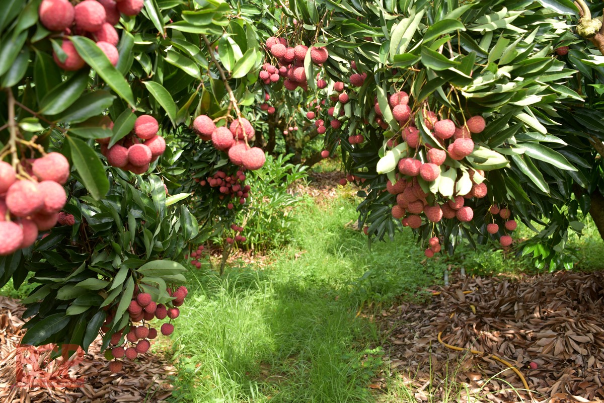
For the mountainous with alternating midlands and deltas topography, it is very favorable for the development of agriculture and forestry. Over the past time, the province's agriculture and forestry have undergone a positive structural change. With an area of agricultural land over 302 thousand hectares, Bac Giang has planned major commodity production areas such as the largest fruit tree area in the North, large areas for processing and safe vegetables, specialized aquaculture area. Especially, Luc Ngan lychee areas are grown according to VietGAP and GlobalGAP standards. Total flock of chickens ranked the 3rd, total herd of pigs ranked the 4th in the country. The area of forest land is nearly 146,000 hectares, of which over 50% is forest for production with high economic value.
With the continuous application of scientific and technical advances, especially the introduction of new varieties and new cultivation methods into production, the growth rate of the proportion of commodity agricultural products increases each year. Plants with high economic value have been developed and expanded more and more rapidly. Livestock farming according to industrial methods together with aquaculture continues to make greatly positive development steps. Currently, Bac Giang gives priority to calling for investment attraction in projects to develop hi-tech, smart and clean agriculture.
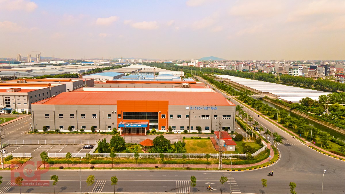
Industry is a potential economic sector in the province. Currently, the province has planned and implemented 06 industrial zones (IZs) with a total area of 1,460 hectares. The IZs of the province are planned in places convenient for transportation: 05 IZs along National Highway 1A and 01 IZ adjacent to Yen Phong IZ - Bac Ninh. Currently, 05 IZs have been put into operation with a total planned area of 1,063 hectares, including Dinh Tram IZ, Song Khe - Noi Hoang IZ, Van Trung IZ, Quang Chau IZ and Hoa Phu IZ. The remaining Viet Han IZ which the Prime Minister has approved the investment policy.
In the near future, Bac Giang will add 3 more IZs, namely Yen Lu IZ, Yen Son - Bac Lung IZ, Tan Hung IZ with a total area of 782.3 hectares and expand 3 IZs including Quang Chau IZ, Hoa Phu IZ, Viet Han IZ with an additional area of 323 hectares.
The province has 40 industrial clusters (ICs) with a total planned area of 1,385 hectares and widely deployed in districts and the city. The ICs are planned and implemented at convenient roads and axes of the province.
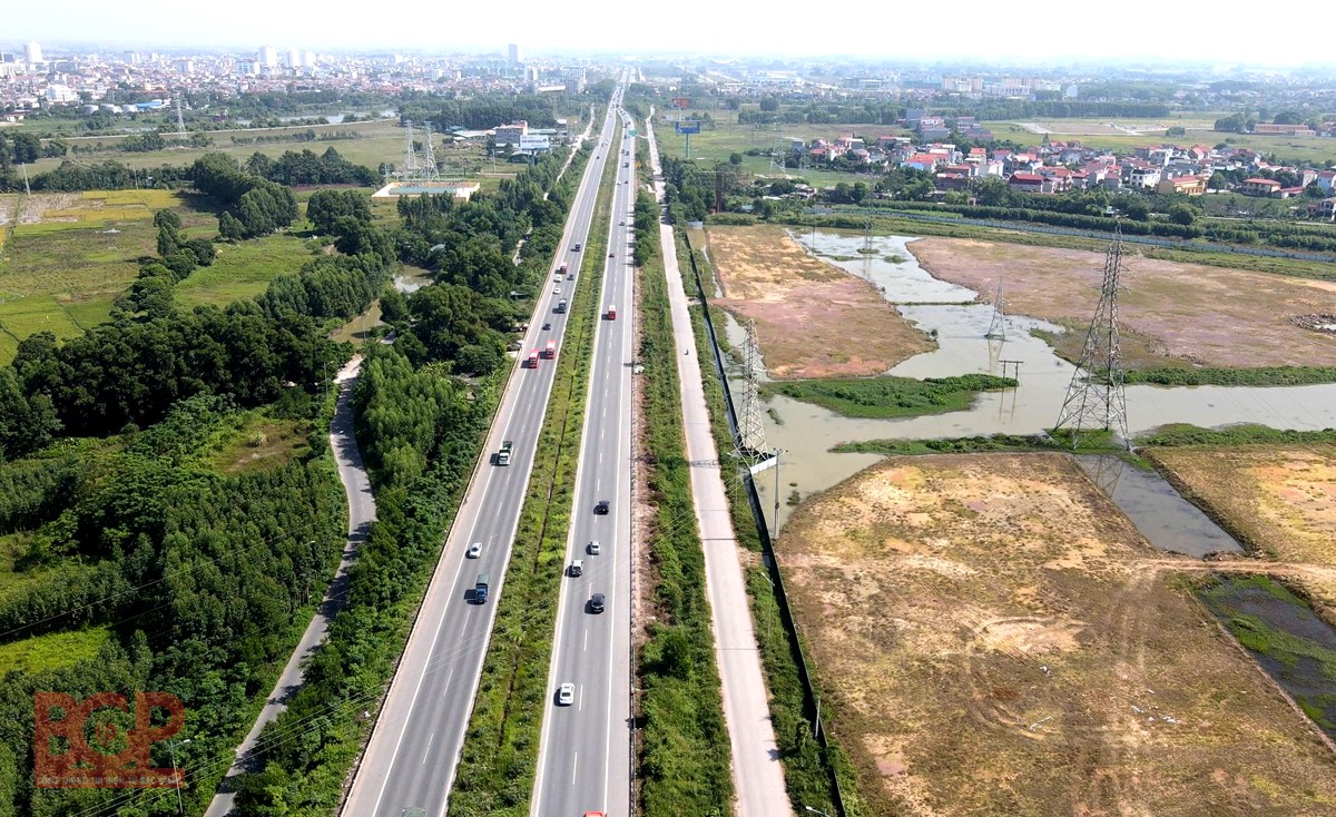
The transportation system of the province is very convenient, including roads, waterways and railways. In which, the road has: Hanoi - Bac Giang - Lang Son Expressway, Hanoi Ring Road 4 connecting Hanoi - Bac Giang Expressway with Hanoi - Thai Nguyen Expressway, National Road 17 connecting Bac Giang with Que Vo Industrial Zone - Bac Ninh, National Road 18 to Quang Ninh, Hai Phong, National Road 37 connecting Bac Giang to Thai Nguyen, etc. Regarding riverways, the province has Cau River, Thuong River and Luc Nam River. The railways include Hanoi - Lang Son route (trade route to China via Huu Nghi border gate) and Kep - Bai Chay route (Quang Ninh).
Information technology infrastructure, high-speed internet network ensure communication and satisfy investors' demands. In addition, the International Logistics Center of Bac Giang city is also under construction and soon put into operation.
Besides, the province has a young, dynamic and capable human resource. The working age population is over 1.1 million people with trained workers account for over 60% of the workforce in the age group. The province currently has 01 university, 3 colleges, 4 intermediate schools and 41 vocational education institutions to meet the needs of high-quality vocational training for the employees.
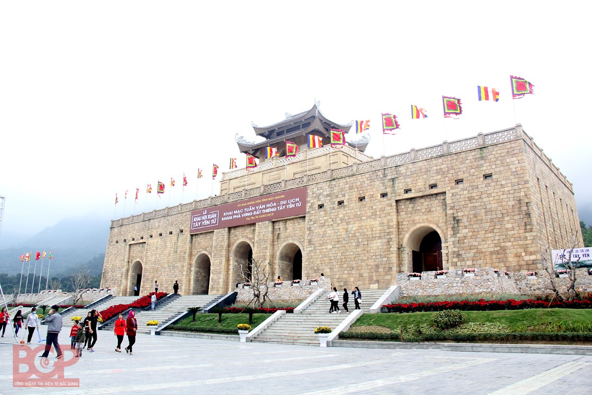
Along with the potentials for industrial and agricultural development, Bac Giang has numerous favorable conditions for tourism development. The province has a system of unique historical, cultural and artistic architectural monuments with more than 2,230 monuments, of which 731 are ranked. The province has many famous cultural and architectural works, in which, a number of typical monuments and works such as Special National Monument - Vinh Nghiem Pagoda (Yen Dung District), Special National Monument Bo Da Pagoda (Viet Yen District), Yen The Insurrection sites, Xuong Giang Victory relic site, Tay Yen Tu spiritual - ecological tourist area, etc. Traditional festivals are still preserved and increasingly promoted and extended. In particular, Bac Giang province has 5 cultural heritages recognized by UNESCO including woodblocks of Vinh Nghiem pagoda, Quan Ho folk songs, Ca Tru, The belief of the worship of Three Goddesses of Vietnameses, Then practice of the Tay, Nung, and Thai in Vietnam.
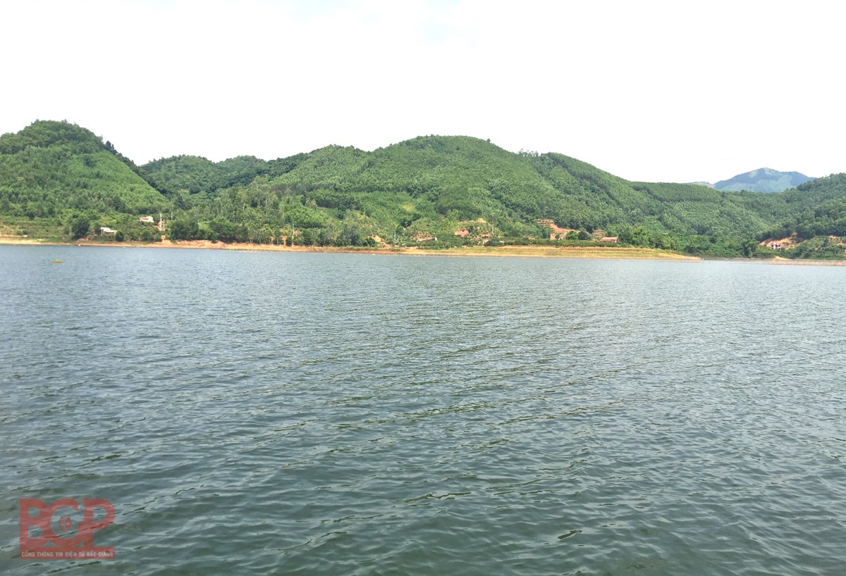
Besides historical and cultural relics, Bac Giang also has many beautiful natural landscapes such as Mo Stream scenic area (Luc Nam district), Cam Son lake, Khuon Than lake (Luc Ngan district), the primeval forest Khe Ro, Tay Yen Tu (Son Dong district) with rich and diverse fauna and flora, many of which are rare species in the Vietnam Red Book that are being preserved, etc. These are the favorable conditions for Bac Giang to develop numerous types of tourism.
With many potentials and advantages along with appropriate development orientation, Bac Giang strives to comprehensively and firmly develop industrial, agricultural and service economic sectors by 2025, making Bac Giang a province with gross regional domestic product (GRDP) in the top 15 of the country./.
BGP