Xuong Giang citadel
Xuong Giang is an ancient citaldel located in the northeast of Bac Giang city, 3 km from the Thuong River. Formerly known as Xuong Giang citadel in Dong Nham commune, Tho Xuong district. Due to its location at the end of the commune, Xuong Giang citadel on the north-east borders Tan Dinh commune (Lang Giang district); In the Southeast, it is bordered by Dinh Ke commune (Bac Giang city); in the west is Va field and San Du field, in the north as Thanh village and Xuong Giang commnue.
According to documents and bibliographies, it is known that after the invasion of our country, the Minh set up the guards and built the fortresses in the places that were crucial for defense. Xuong Giang citdel was built during this time, in 1407 when the Minh founded Xuong Giang guard team. It became the capital of Lang Giang, including Lang Giang district (former Bao Loc), Yen Dung, Yen The, Luc Ngan of Bac Giang province, Huu Lung in Lang Son province and as the firmest citadel on the way to connect the Guangxi station route (China) with Dongguan. This is a fairly large city built on a high land at the foot of the low hills are tributaries of Thuong River, named Cau Do River, Cau Thao River. The cover is made of rectangular earth. The length is located east-west measured 600m, the width is north-south measured 450m. Area about 27ha (equivalent to nearly 70 acres). The walls are covered with high and thick earth. Four corners form four fortresses higher than the surface of about 4m. The outer wall has a deep ditch covering. There are still signs that the sincerity of the Northeast is still 25m wide. The remaining walls have a width of up to 20m and a height of up to 4m. The banks of the west are almost completely leveled. The ditches surrounding the city have been leveled up almost all the land. However, the remaining traces are still 15m wide and 1m deep. The four doors look in four directions. The main door looks west, leaving only the east door. At each gate there is a round rice field, which is more than 1 sao wide and deep in size, the people still call it "fighting." Water drainage through the south gate and west entrance.
In the district divided into areas, headquarters, barracks, salaries, prisons ... In the inner city today there are still many mounds of low and high different, higher than the "hill army (or King ) Wu "lies slightly north-east. About 300m from the land of Ha Vi village (divided after liberation). Armed food stalls, camps were built around the "Ngo hill" near the northern bank. This is determined by the cultivation process, the local people also dug up a lot of rice burned to charcoal, large rocky legs, the stone bullets of different sizes in different sizes from 3cm to 12cm. These objects are kept by the local museum. Most of the stone found in the northeast and northwest corner of the city, lying in the coal ashes near the heart. Along with the stone bullets also found the rock column footprints. The number of statues is pretty much lined up, including many different types. The stones made of salt rock or rectangular-shaped limestone have the length of 60 cm to 100 cm, width 40-50 cm, thickness 30 - 40 cm. In addition, there are many terra cotta objects such as brick, tile, porcelain, porcelain ...
Bricks found on the wall, in the wall and in the soil in the outside. The bricks are found in many different shapes and sizes, often in red or shades. The bricks are usually not patterned. These bricks of the Le dynasty, usually found in the Lam Son (Thanh Hoa), Chi Lang (Lang Son) relics. The bricks found in Xuong Giang citadel are of the buildings built in the city.
Through the remaining vestiges on, we can confirm that Xuong Giang is an important historical site. Here before the city was a large site from the Ly - Tran era with the palace was destroyed. In addition, many other relics show that right from the first century BC and during the rule of our country, the feudal North has occupied Xuong Giang. By the time the Minh invaders, they built the citadel right on the ancient ruins of the Ly - Tran. And the soil of the Ly - Tran dynasty has been dug up to fill the walls, leading to the phenomenon of artifacts of many times overlapping. However, the traces of the city and the relics found are evidence of a glorious historical period: "The siege period of Xuong Giang, advanced to destroy the entire Minh military in 1427. Successfully finished the war of liberation country in the early 15th century of our nation.
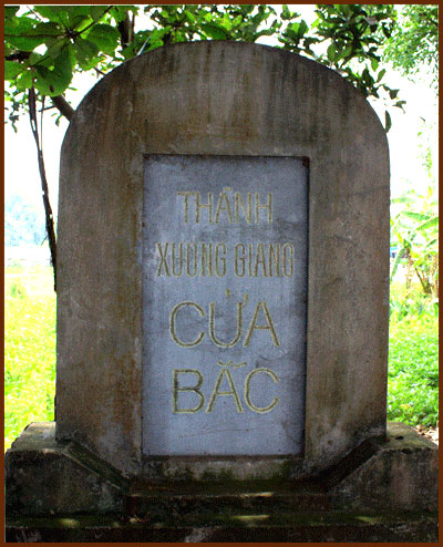
With that historic significance, on January 22, 2009, the Ministry of Culture, Sports and Tourism issued Decision No. 293 / QD-BVHTT-DL, ranked Xuong Giang citadel as a Xuong Giang historic victory at national level. There are 14 monuments: North East Gate, East Gate, North Gate, South West Gate, South Gate, Central Area, trace of citadel, Xuong Giang River flows through the city; Archaeological excavation sites No.2, No.3, Phu well, Thanh temple and two points outside the protected area are: Southeast gate and West gate. Protected sites are scattered at intermittent locations of residential areas of Dong Giang, Nam Giang, and Bac Trau communes in Xuong Giang commune.
At present, the People's Committee of Bac Giang city is implementing the first phase of the project of preserving, upgrading and promoting the value of the historical victory area in Xuong Giang. The complex includes the victory monument of Xuong Giang, the Memorial House, the Square ...